Takeaway and meeting docs
Last Saturday’s forum, “The Ross Barnett Reservoir and Our Communities,” was a success! Residents from Canton Club, Colonial Heights, McLeod, and other Northeast Jackson residents had the opportunity to listen to and talk with Mr. John Sigman, General Manager of the Pearl River Valley Water Supply District (PRVWSD)–the Reservoir’s governing body.
We discussed the dam’s flood control limits, community representation on the PRVWSD board, and the One Lake project. You can watch a recording of the forum on MCUP’s YouTube Channel. (As always, a big thank you to Albert Williams for filming and posting the video.)
This post shares my top takeaway from the meeting, and I encourage you to share what statement or topic caught your attention. It also shares digital copies of the documents Mr. John Sigman and his team handed out.
Takeaway: Who represents Hinds County and Jackson on the Reservoir’s Board?
The PRVWSD is headed by fourteen Board of Directors. Four members are from state agencies, and ten are from the counties surrounding the Reservoir, Hinds, Leake, Madison, Rankin, and Scott. Each county gets two seats: one is appointed by the Governor, and the other is appointed by the respective county’s Board of Supervisors.
There is a caveat. According to Mr. John Sigman, the Governor of Mississippi has left the Hinds County appointment vacant for eight years. Meanwhile, Dr. David Williams, the Hinds County Board of Supervisors’ appointee, has failed to attend any PRVWSD Board of Director meetings during his three-year tenure. Hinds County, the most populous of the five counties, has no representation on the PRVWSD Board of Directors. Mr. John Sigman’s statements may be found on the following embedded video.
The PRVWSD Board dictates how the Reservoir operates. After the 2020 flood, it voted to increase the structure’s flood storage capacity by lowering the lake during the rainy season. According to Mr. Sigman, this action could decrease flooding along the Pearl River at Jackson by approximately 2 feet.
Could the Reservoir provide even greater flood reductions if its operations were changed further? What if there is an effort to stop lowering the lake during the rainy season? These questions will arise in future PRVWSD Board meetings. Who will represent Jackson’s and Hinds County’s interests then? Currently, no one will.
Documents
Mr. John Sigman handed out several documents. You may find most of them here…

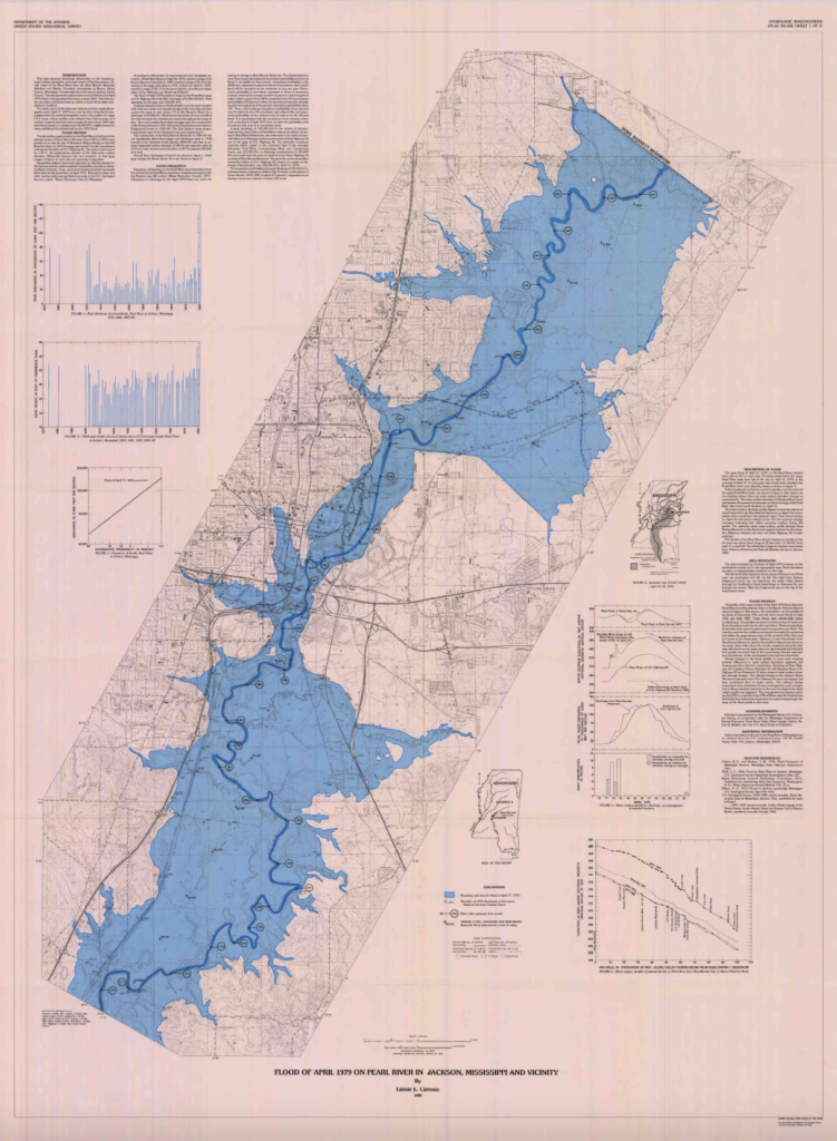
The extent of the 1979 Easter Flood
What parts of Jackson were flooded in April of 1979? The USGS map shows the extent of the flooding.

Flood control design
Why was the reservoir not designed for flood control? State Rep. and Engineer Horace Lester Explains why in a 1964 article.

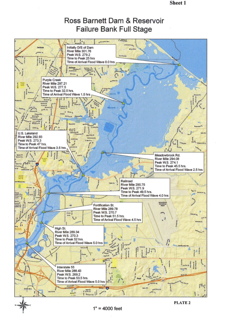
Emergency Action Plan
What happens if the Reservoir’s dam breaks? The structure has an Emergency Action Plan (EAP) detailing what areas will be affected by a dam breach.
- EAP
- Large map of NE Jackson (pending)

Flood Control Comparison Reservoir Vs. North Mississippi
How does the Ross Barnett Reservoir compare to North Mississippi’s Flood Control Lakes? Mr. John Sigman provided data showing that the Reservoir drains an area 3 to 8 times larger than the drainage areas of North Mississippi’s lakes but only has a tenth to a quarter of the storage capacity.


Leave a Reply